During my visit to the Upper Palatinate, I took part in a hike near Bad Neualbenreuth. Both tours are easy to manage with only moderate gradients and on good paths, even for inexperienced hikers.
From a visit to an extinct volcano and the step to the Czech Republic
We started our hike after a hearty snack at the Adamhof Inn in Hardeck.
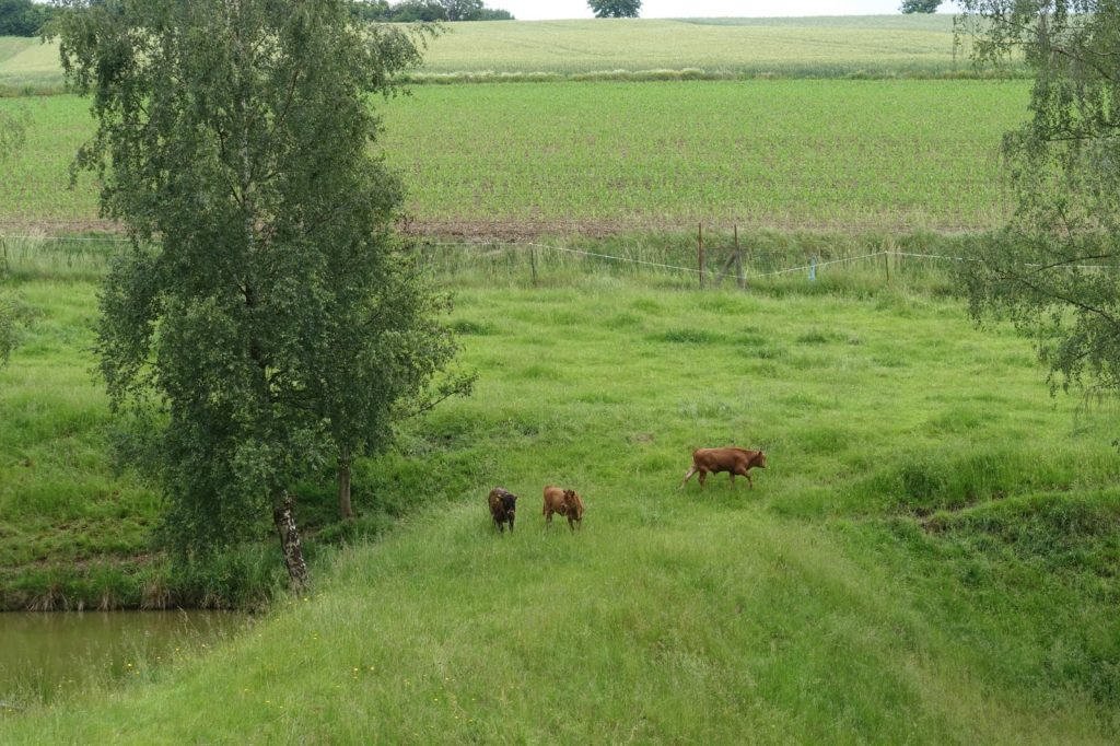
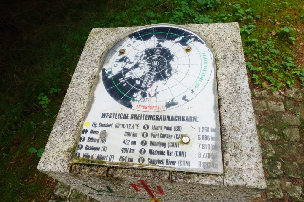
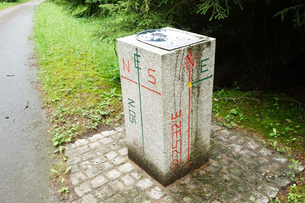
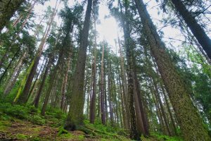
The path first led us slightly uphill past the pasture of some Dexter cattle with their calves. Then we entered the forest and followed the signposted path until we discovered two conspicuous stones at the side of the path. The 50th parallel of the northern hemisphere runs exactly at this point.
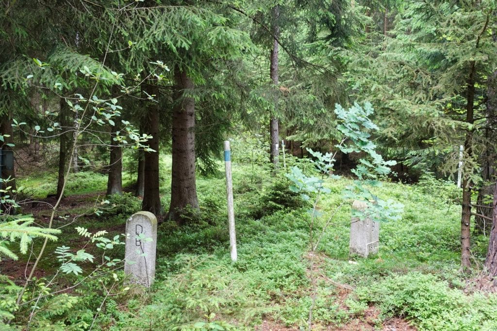
A short time later we came to some white-blue wooden poles and border stones. This is where the German-Czech border runs. It was to accompany us in many places during our hike and in some sections we partly walked on Czech territory. Even though there are no regular border controls here, you should have your passport with you. It can always happen that there is a check.
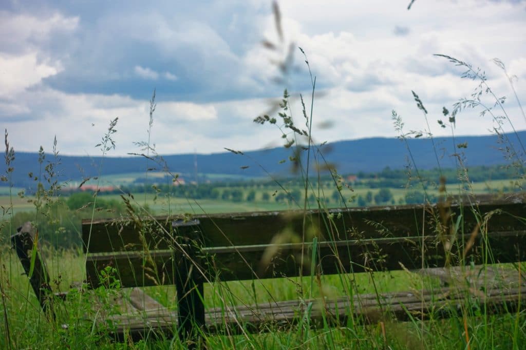
After a while we left the forest and came to the border chestnut tree. From there you have an excellent view and can rest on benches. There is also a small shelter that can be used in case of bad weather.
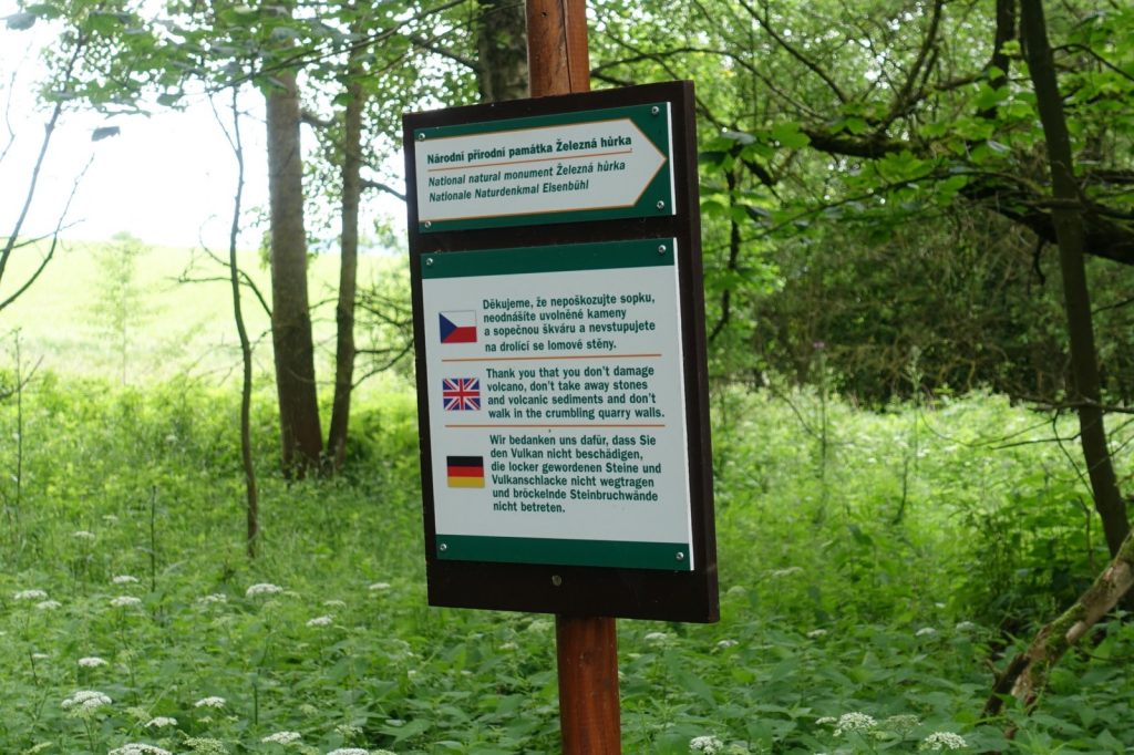
We walked along the edge of the field and came closer and closer to our destination, the extinct volcano Eisenbühl. A small sign points to an almost overgrown trail, which we followed for a short distance.
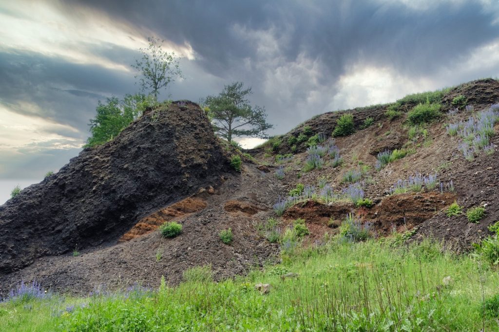
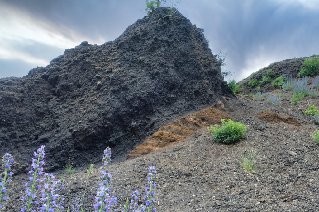
Then we stood in the former crater of the volcano. To the side rises a craggy rock face about 25 metres high. You can clearly see the different layers of rock.
The Eisenbühl volcano is a special geological feature. With the folding of the Alps, fault lines developed that also run through the Upper Palatinate Forest. Through these fault lines, material from the earth’s interior reached the earth’s surface. This led to lively volcanic activity in the region, which still has an impact on the area today. For example, there are carbonated mineral springs around Bad Neualbenreuth that were created as a result of this process. The extinct volcano Eisenbühl is also a remnant from this time. I really find this place very exciting. The way nature has reclaimed the volcanic earth and the many small and larger volcanic stones that lie here make the place incomparable to its immediate surroundings.
A little story on the side: On 23 August 1823, Johann Wolfgang von Goethe visited a friend in the region. Together they visited the Eisenbühl volcano. He is said to have collected rocks with enthusiasm. Yes, and actually he wanted to travel to the region again, if a woman had not intervened. Goethe, who was 72 at the time, was madly in love with the 17-year-old Ulrike von Levetzow. She did not listen to him and so he travelled on.
We climbed a small incline out of the volcanic crater and walked back along the edge of the crater to the small trail that brought us back onto the hiking path.
We passed an interesting sign after a short while. It points to the small village of Boden, which was completely destroyed after the Second World War. Boden was located in a small deciduous forest about 600 metres behind the German border with the Czech Republic. Most of the inhabitants fled from their village to neighbouring Bavarian communities in 1945/46. Because of the proximity to the border, it was decided to raze the village to the ground.
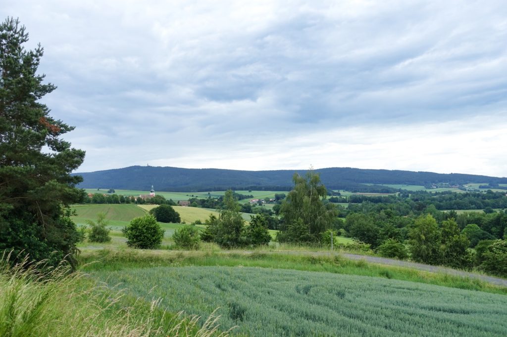
It is now only a few metres to Bad Neualbenreuth, which you walk along an asphalted road between the fields. You can enjoy the relaxing view of the beautiful landscape.
Our hike ends at the school of Bad Neualbenreuth, which is located slightly above the parish church.
Hike near Bad Neualbenreuth – our route:
Hike near Bad Neualbenreuth: Rinnlstein circular trail
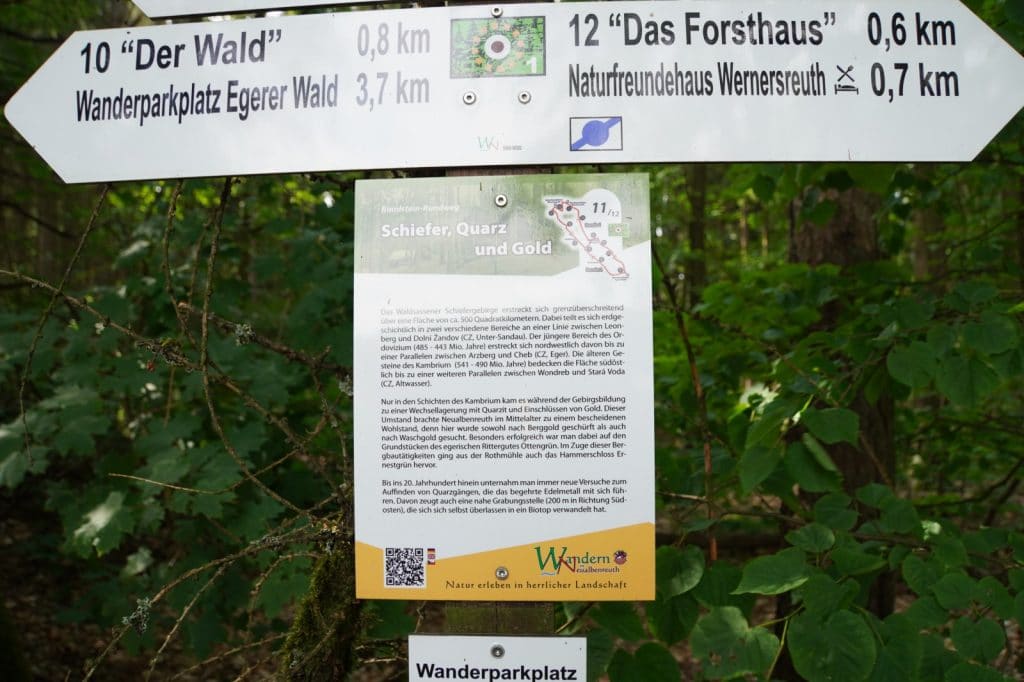
We started another hike near Bad Neualbenreuth at the Naturfreundehaus Wernersreuth. Here you can join the Rinnlstein circular trail. The trail has only moderate gradients and runs in an uneven figure of eight over about 9.5 km. So it is also possible to shorten the tour.
I particularly like the information boards, which tell something about the history of the region at 12 stations.
We didn’t quite follow the signposted route, as you can see from the route that I have subsequently entered.
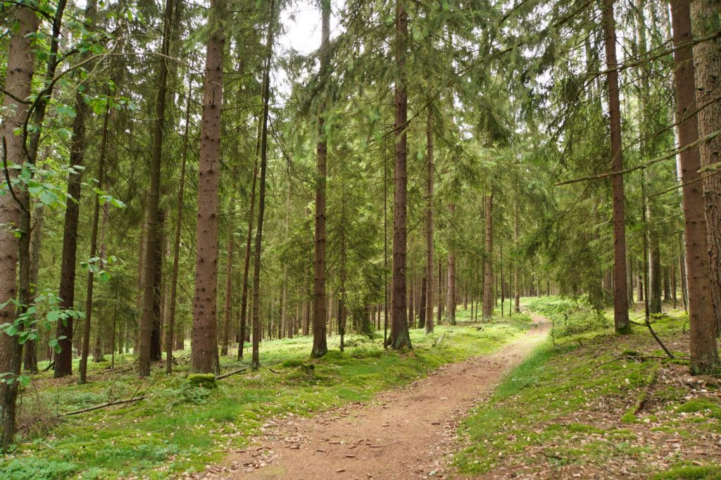
The paths led us through a dreamlike forest, the ground was soft and springy with every step and it smelled wonderfully of the forest. After a while we reached the highest point of our hike, the Birkenberg at 744 metres. And now a little mountain information: at 744 metres, the Birkenberg is the 1168-highest mountain in Bavaria and the 1658-highest mountain in Germany.
The name of the mountain goes back to the form of cultivation at the end of the 17th century. The birch trees were felled within 15-40 years. Afterwards, the area was grazed for two years until the stock of fast-growing birch trees had increased again (e.g. through wild sowing). At the end of the 19th century, the tree population was converted into a coniferous commercial forest due to changes in soil conditions.
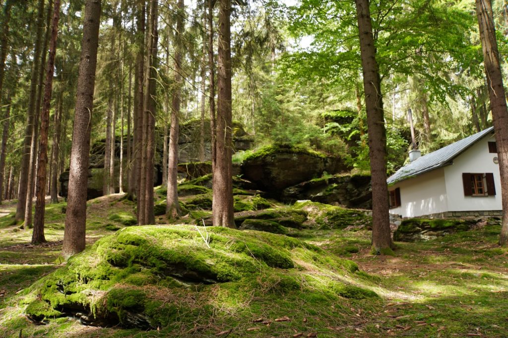
Following the signposted paths, we finally reached the Ringelfelsen (also Rinnlstein, Ringelstein). From a geological point of view, the rock formation belongs to the Schiefergebirge. The rock owes its name to the Rinnlbrunnen, a nearby spring. Below the rock is a hikers’ hut run by the Naturfreundehaus Waldsassen. Here we could enjoy a break with sausages and potato salad on beer benches under the trees before heading back to the starting point.
Disclosure: Both hikes near Bad Neualbenreuth were part of a blogger trip. The report was written independently and corresponds to my experience.


Leave a Reply